
AtloMaps Outdoor Navigation
ATLOGIS Geoinformatics GmbH & Co. KG
Updated Jul 13, 2026 · v1.0.5

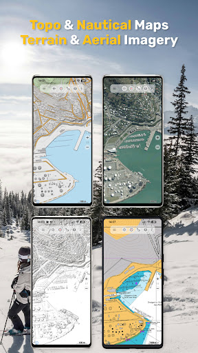


Outdoor & Offroad GPS Navigation with Topo Maps, Aerial Images & Overlays
Offline GPS Navigation & Topographic Maps with 300+ Map layers Access one of the most powerful mobile mapping and navigation platforms available. With 300+ base maps and 100+ overlays, AtloMaps gives you unmatched control over how you explore and analyze the world — whether you're a professional, outdoor enthusiast, or traveler in remote regions. Discover far more detail than with standard map providers: Many regional topographic maps reveal small trails, remote paths, terrain features, and waterways that are often missing in common maps. In addition, high-resolution aerial imagery is available for many countries — and can be downloaded for offline use. From high-detail topographic maps and aerial imagery to terrain models, historical maps, and nautical charts — everything in one app. 🗺️ AtloMaps Base Layers Our custom-built map layers provide a consistent, high-quality global mapping experience: • AtloMaps OSM International – global map with Latinized labels • AtloMaps OSM Native – map with local language labeling • AtloMaps OSM Landcover – enriched with ESA landcover data • AtloMaps OSM Physical – physical map with terrain relief and 10 m contour lines • AtloMaps Hillshading v4 – high-resolution hillshading, in many regions based on LiDAR DEM data Designed for maximum clarity, detail, and readability across all zoom levels. 🌍 Unmatched Map Variety Explore an extensive collection of global and regional maps: • Topographic maps from many countries • OSM, Google, Bing and ESRI maps • Specialized regional datasets • Satellite & aerial imagery • Terrain models & hillshade layers • Landcover and physical maps • Historical & military maps Enhance maps with overlays: • Hiking, cycling, and MTB routes • Contour lines (elevation) • Slope shading & terrain visualization • Grid systems (UTM, MGRS, etc.) • Many more thematic layers Compare maps with adjustable transparency and combine multiple layers. This is not just a map viewer — it’s a complete mapping toolbox. 🧭 Advanced GPS Navigation & Tools Professional-grade navigation features: • Real-time GPS positioning with high accuracy • Record tracks with distance, speed, elevation, and accuracy • Trip computer with customizable data fields • Create, edit, and navigate to waypoints • Route planning and navigation • GPX, KML, KMZ import & export • Display coordinates in Lat/Lon, UTM, MGRS • Measure distance and areas • Elevation profiles and tap-to-query • Track replay and analysis Reliable tools for anyone who depends on accurate location data. 📡 Offline Maps & Navigation Use the app anywhere — even without internet: • Download maps for offline use • Automatic tile caching for viewed areas • Bulk download for large regions • Full offline GPS navigation Perfect for: • Remote mountains, deserts, and forests • International travel without roaming • Expeditions, field work, and research No signal? No problem. ⚙️ Advanced Mapping Features Go beyond standard apps: • Add custom map sources (WMS, tile servers) • Import custom maps (GeoPDF, GeoTIFF, MBTiles, OZI) • Support for multiple coordinate systems and projections • High-performance map rendering Designed for users who need full control over their map data. 👥 Designed for Professionals & Adventurers Ideal for: • Travelers exploring remote regions • Hikers & mountaineers • Cyclists & overlanders • Sailors & pilots • Researchers & field workers • Engineers & GIS professionals If you care about map detail, projections, overlays, and data quality — this app is for you. ⭐ Pro Features Upgrade to unlock: •Turn-by-turn routing (hiking, cycling, etc.) • Unlimited tracks & waypoints • Ad-free experience • Advanced export options • Extended offline capabilities 🔐 Privacy First Your data stays yours. • No tracking • No data selling • Location data stays on your device Trusted outdoor navigation apps — built by Atlogis since 2011. If you have any questions don't hesitate to ask support@atlogis.com
0 years on Google Play
This app isn't currently appearing in any tracked top charts.