
SeaNav Boating navigation
Updated Jul 30, 2026 · v3.3.20




Marine charts, AIS, GPS navigation, routes & weather
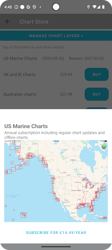
Professional marine navigation with official charts, live AIS and advanced route planning. It’s like Google maps for your boat. Plan, navigate and explore with high-resolution official marine charts covering US, Canada UK & IE, Europe and Australia. SeaNav combines charts, routing, AIS and weather in one powerful , easy to use and affordable — navigation app. Charts available with a free 3 day trial. ⸻ 🧭 Plan Smarter • Create and edit routes • Auto-advance waypoints • Measure distance & bearing • Import & export GPX routes • Works offline ⸻ ⛵ Navigate with Confidence • Real-time GPS navigation • Course Up & North Up modes • ETA, XTE, VMG, SOG & COG • Sailing HUD display • Background navigation • Waypoint reached alerts • MOB and Anchor alarm (IAP) • Night mode display ⸻ 📡 Live AIS & Safety (Optional IAP) • Real-time AIS ship positions • Collision alarms • AIS position sharing • Internet AIS integration • Free AIS when used with Boat Beacon ⸻ 🌊 Charts & Marine Data • Official high-resolution vector charts • Seamless pan & zoom • Buoys, lights, bridges & depths tappable • Real-time distance & bearing to chart objects • Configurable layers • Satellite overlay • NMEA instrument support (via Wifi or USB) Charts available for: US, Canada, BVI, Bermuda, UK & Ireland, Germany, France, Netherlands, Belgium, Norway, Spain, Croatia, Portugal, Sweden, Italy & Australia. ⸻ 🌦 Weather & Tides (Optional IAP) • Wind & wave forecasts (7 days) • Tidal heights & tidal streams • Moon & sun times ⸻ 🎓 Try Everything Free Built-in demo mode gives free access to charts, AIS, weather and tides. The free version includes all route planning and navigation tools. High-resolution vector charts are available via 12-month subscription including updates. ⸻ 🔋 Requirements • GPS required for live navigation • Internet required for live AIS • WiFi-only devices require external GPS ⸻ ⚠ Important Continued GPS use in background may reduce battery life. ⸻ 📜 Legal Contains material derived from UK Hydrographic Office data. © British Crown Copyright. Full Terms of Use: http://seanav.net/termsofuse.php Privacy Policy: http://seanav.net/privacy.php Support: help@pocketmariner.com
0 years on Google Play
This app isn't currently appearing in any tracked top charts.