
Mapas de España
Centro Nacional de Información Geográfica - CNIG
Updated Jan 15, 2026 · v4.5.2

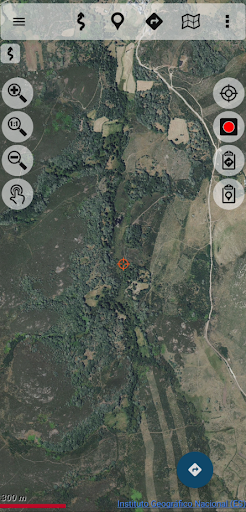


Ideal for hiking, biking display, running or skiing, etc
A free map viewer ideal for hiking, cycling, running, or skiing, using maps from the National Geographic Institute and other services from various ministries, such as cadastral information provided by the Directorate General of Cadastre. With this app, you can explore numerous routes in the Routes, Leisure, and Free Time section and record or use your tracks/routes, plan excursions using maps, navigation, and guided tours, all without an internet connection. All maps and routes used are free and allow you to: - GPS location, even without mobile coverage - Offline map mode: save maps in advance - Trace routes (tracks) with GPS on National Geographic Institute maps - Save and view tracks in GPX, KML, and KMZ formats - Supports WMS and WMTS map services; you can use the app as a WMS viewer - View your position using coordinates, heading, speed, and altitude. Distance Calculation - The application is available in Spanish, Catalan, Galician, Basque, and English. - Based on OruxMaps software. Maps of Spain is used as a GIS tool, originates from a Spanish government department (https://www.ign.es/web/ign/portal), and is used by various professionals, including Spanish state employees (police officers, forest rangers, firefighters, etc.). It is common to have the catalog of maps of Spain stored internally. For example, databases in mbtiles format: https://centrodedescargas.cnig.es/CentroDescargas/loadMapMov.do It is not possible to move all this information to the private storage of each app that wants to use this data (we are talking about tens or hundreds of gigabytes). And from public storage, using the Android file access system, direct and random access to files is not permitted, which is required by the app to access databases or binary map formats. Without this permission, professional and non-professional users who regularly use the app as a GIS tool will no longer be able to use it as needed. Official Publication Identification Number (NIPO): 162190330
10 years on Google Play
This app isn't currently appearing in any tracked top charts.