
Tidal Stream Atlas, Dover
Updated Aug 7, 2025 · v2.3
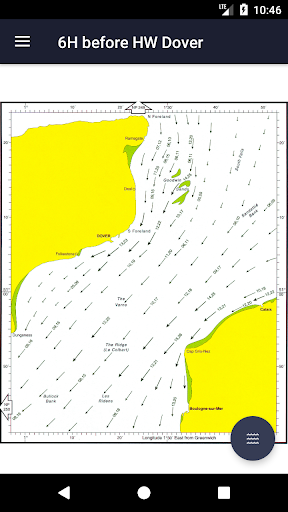


All sea maps from the Tidal Stream Atlas for the Dover Strait
All charts are available offline. The charts show both direction and rate of tidal streams at hourly intervals by careful and accurate use of graded arrows and display mean neap and spring tidal rates in tenths of a knot. The app also shows you today's tides at Dover, for which an internet connection is required. This app is universally available on both your iPhone and iPad. The sea maps are zoomable, thus also of good use on the smaller phone screen. All charts © Crown Copyright and/or database rights. Reproduced by permission of the Controller of Her Majesty’s Stationery Office and the UK Hydrographic Office (www.ukho.gov.uk). Disclaimer: We do our utmost to deliver you the best software and data available in the market, but of course we cannot guarantee the proper functioning or accuracy of both. Data sources can change over time. You can not derive rights from this information. By downloading and using this tidal stream atlas you accept these terms.
8 years on Google Play
This app isn't currently appearing in any tracked top charts.