
Agri Drone Way
Updated Nov 20, 2025 · v1.1.15




Monitors agri-drone paths via RTK device of SYNEREX, Inc.
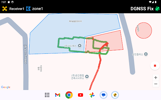
This app monitors the movement paths of agricultural control drones based on a high-precision positioning service using SYNEREX's RTK device. The tablet must be connected to the internet via Wi-Fi or cellular data. When the tablet successfully connects to the server, the satellite icon on the far right of the AppBar turns blue. Once the RTK device begins transmitting location data to the tablet, the icon blinks green to indicate active data reception. UI Elements On the Right side of the screen, the current location and speed of the drone received from the RTK receiver is displayed (the section which includes drone Icon). Tapping it moves the map to the drone’s position. The section which have map icon shows the screen map's center position At the bottom right of the map, there are buttons for the menu and zoom in/out functions. Settings Menu Zones: Define and display zones for spraying and no-fly areas on the map. RTK Receivers: Register the RTK devices to be used. Clear Trajectories: Clear the flight path history remaining on the map. Start Tracking: Begin recording the drone’s flight trajectory.
1 year on Google Play
This app isn't currently appearing in any tracked top charts.