
Tide US
Updated Jul 24, 2026 · v2.9




Tides of US ports
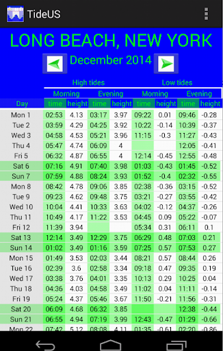
Times, heights of many US ports. Application made from the harmonic constants provided by NOAA. These harmonic constants are freely available for consultation, for example: https://tidesandcurrents.noaa.gov/harcon.html?id=8723214&name=Virginia%20Key,%20Biscayne%20Bay&state=FL This application doesn’t represent a government entity. All displayed local time, are in the summer and winter hours. No use of geolocation data outside the application and only to locate the nearest port. The menu is used to calculate the tides and to give specifics on a day or month. Choose your own threshold (minimum height for sailing or fishing for maximum distance). Enter a head of water and set schedules for which it will be reached or for such time before any water depth. Thank you to share your comments to further improve the application.
11 years on Google Play
This app isn't currently appearing in any tracked top charts.